

Driven by Technology and Concepts
Disaster Prevention New Concept
| Category | English Name | Formula |
|---|---|---|
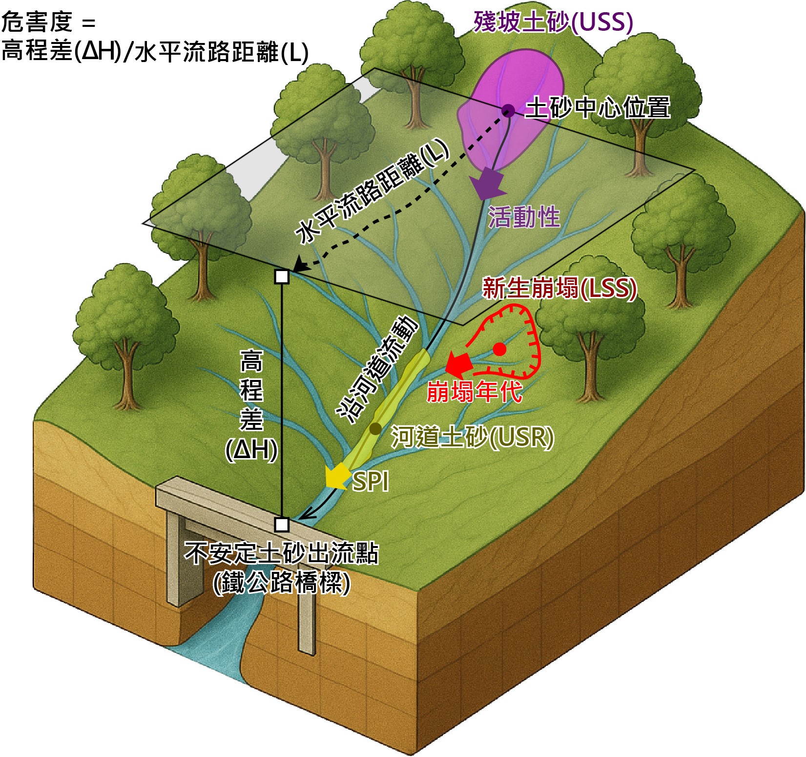
| 殘坡土砂(USS) | Unstable Sediment on Slope | PUSS = Sediment Volume × Activity × Hazard |
| 河道土砂(USR) | Unstable Sediment on River | PUSR = Sediment Volume × SPI Classification × Hazard |
| 新生崩塌(LSS) | Landslide Sediment on Slope | PLSS = Sediment Volume × Annual Reduction Factor × Hazard |
| Total Potential Value | Ptotal (Pt) = PUSS + PUSR + PLSS | |
| Potential Level | Ln(Pt/Area) Condition | Description |
|---|---|---|
| Low Potential Value | Ln(Pt/Area) < 1.0 | Lower potential, minor hazard |
| Medium Potential Value | 1.0 ≤ Ln(Pt/Area) < 2.4 | Medium potential, requires attention |
| Medium-High Potential Value | 2.4 ≤ Ln(Pt/Area) < 3.6 | Higher potential, monitoring recommended |
| High Potential Value | 3.6 ≤ Ln(Pt/Area) < 5.5 | High potential, requires strict monitoring and prevention |
| Extremely High Potential Value | Ln(Pt/Area) ≥ 5.5 | Extremely high potential, may cause significant hazard |
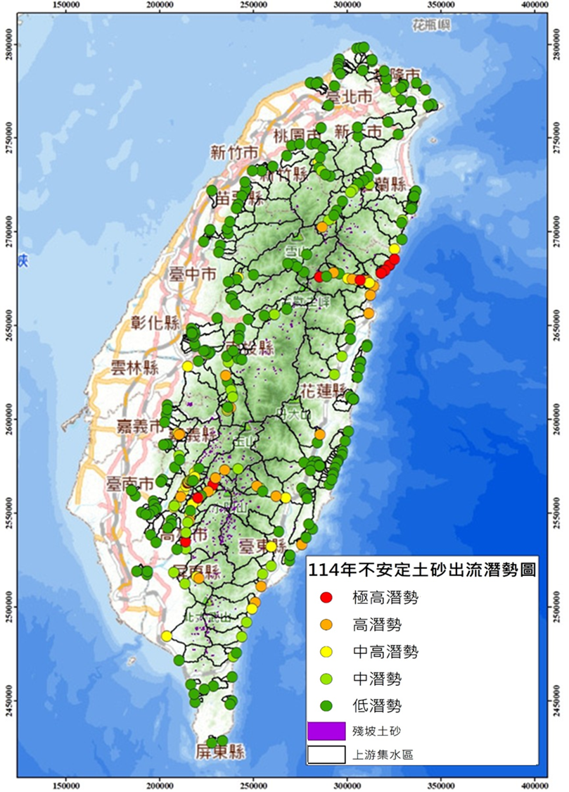
Unstable Sediment Potential Map
Agency of Rural Development and Soil and Water Conservation(ARDSWC), MOA.
No.6, Guang-Hua Rd., Chung-Hsing New Village, Nantou, Taiwan, R.O.C.
Office hour:Monday to Friday
08:30~12:30, 13:30~17:30