

1
Burial
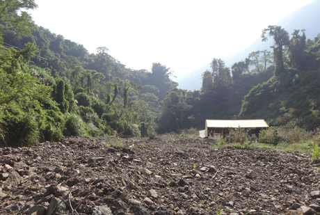
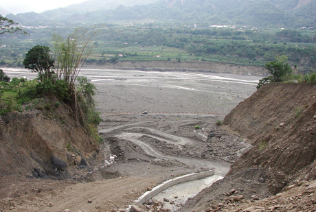
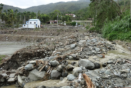
Deposition and burial on the downstream alluvial fan.
Deposition and burial on the downstream alluvial fan.
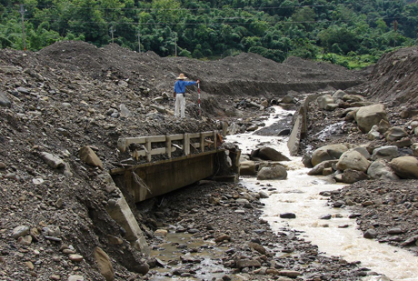
Erosion of both sides of the stream channel and downcutting of the streambed.
Narrow streams and low culverts are prone to blockage by sediment, rocks, or driftwoods.
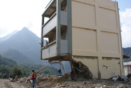
debris flow possesses extremely strong impact force, easily destroying or penetrating structures.
The original stream channel is diverted due to debris flow deposition or bank collapse.
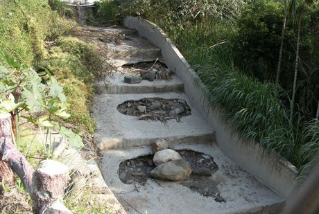
Concrete structures, such as levees and check dams, are worn down by debris flow.
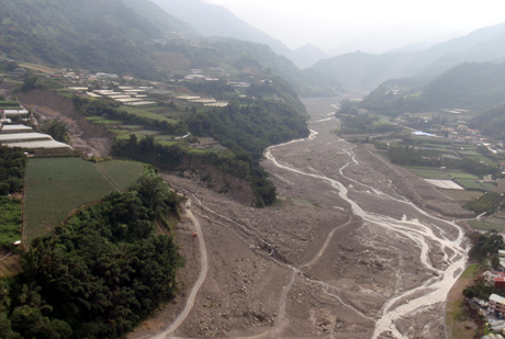
The main channel is constricted by bank collapse on both sides and sediment carried in by tributaries.
| Debris Flow Disaster Type | Description | Response Strategies | |
|---|---|---|---|
| Hard Infrastructure | Soft Measures | ||
| Burial | Deposition and burial on the downstream alluvial fan | Stream Works, Ecological Engineering | Delineate debris flow potential areas, restrict development, and assist residents in downstream deposition zones with relocation or early evacuation to safe shelters |
| Erosion | Erosion of both sides of the stream channel and downcutting of the streambed | Stream Works | Restrict development on both banks and establish buffer zones; ensure early evacuation to safe shelters for residents on both banks |
| Blockage | Narrow streams and low culverts are prone to blockage by sediment, rocks, or driftwood | Dredge or clear the channel to prevent blockage, widen the channel, reduce the number of bridge piers, and increase the cross-sectional area of culverts | Monitor water levels and culvert blockage; promptly notify residents along susceptible channels for evacuation to safe shelters |
| Impact | Debris flow possesses extremely strong impact force, easily destroying or penetrating structures | Stream Works, Bridge Works | Assist residents in debris flow potential areas with relocation or early evacuation to safe shelters |
| Stream Diversion | The original stream channel is diverted due to debris flow deposition or bank collapse | Stream Works | Assist residents in areas prone to collapse or channel deposition with relocation or early evacuation to safe shelters |
| Abrasion | Concrete structures, such as levees and check dams, are worn down by debris flow | Stream Works, Slope Protection Works | Inspect engineering structures for damage that may reduce protective effectiveness |
| Main Channel Constriction | The main channel is constricted by bank collapse on both sides and sediment carried in by tributaries | Stream Works | Delineate debris flow potential areas, restrict development, and assist residents with relocation or early evacuation to safe shelters |
| Section | Topographical Features | Phenomena | Mitigation Objective | Mitigation Mechanism | Applicable Engineering Method |
|---|---|---|---|---|---|
| Source Area |
|
Unstable sediment movement in the streambed and talus slopes | Prevent the occurrence of debris flow | Stabilize unstable streambed sediment | Series of sediment control dams and 『check dams』 |
| Gully collapse, 『landslides』 | Control the occurrence of gully collapse and 『landslides』 | Series of sediment control dams, retaining walls, slope protection works, etc. | |||
| Rainfall infiltration and surface runoff | Streambed dissipation and surface and subsurface drainage for slopes | Series of concealed dams, 『check dams』, drainage facilities, subsurface horizontal drainage, etc. | |||
| Transport/Runout Area |
|
debris flow impact | Prevent debris flow propagation/development | 1. Block boulders 2. Reduce flow velocity |
Permeable dams (slit dams, notch dams, grid dams, etc.), series of sediment control dams, semi-permeable dams |
| debris flow overflow | Raise and reinforce stream banks near overflow points | Revetments, foundation protection works, guide walls | |||
| Increasing debris flow volume | Consolidate streambed and banks, block sediment | Series of sediment control dams, 『check dams』, permeable dams, semi-permeable dams | |||
| Subsequent sediment-laden flow overflow | Appropriate engineering design and reduction of sediment deposition in the streambed | Dredging/Clearing, appropriate engineering design (e.g., reserving sufficient freeboard) | |||
| Driftwood | Block driftwood | Permeable dams, semi-permeable dams |
Agency of Rural Development and Soil and Water Conservation(ARDSWC), MOA.
No.6, Guang-Hua Rd., Chung-Hsing New Village, Nantou, Taiwan, R.O.C.
Office hour:Monday to Friday
08:30~12:30, 13:30~17:30