


Soft Measures for Disaster Avoidance
Establish an alert and evacuation mechanism to timely evacuate residents before a disaster strikes and reduce casualties.
Establish an alert and evacuation mechanism to timely evacuate residents before a disaster strikes and reduce casualties.
Use engineering methods to mitigate the impact of disasters on the environment while balancing safety and ecology.
Strengthen land conservation work within the framework of national land planning to ensure sustainable land use.
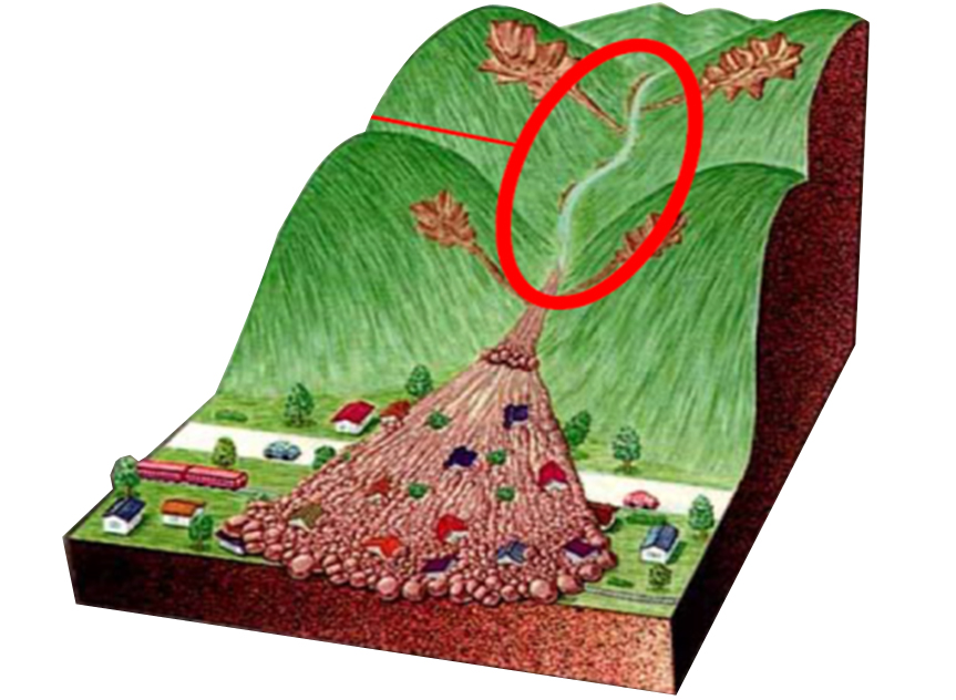
Primary Definition: Possesses the geomorphological and hydrological conditions for debris flow occurrence
Evaluation Factor: Occurrence Potential
Scope Designation: Designated location and boundary
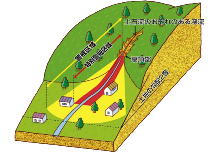
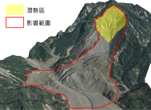
Primary Definition: Potential areas for debris flow disasters (with households under protection)
Evaluation Factor: Residential Area Hazard Level
Scope Designation: Designated torrents and areas of impact
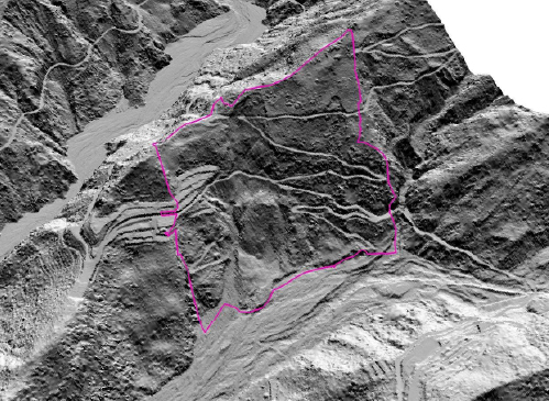
Primary Definition: Areas with a serious risk requiring immediate engineering work and land-use restrictions
Evaluation Factor: Priority of Control and Management
Scope Designation: Designated planning area (Disaster Potential Map)
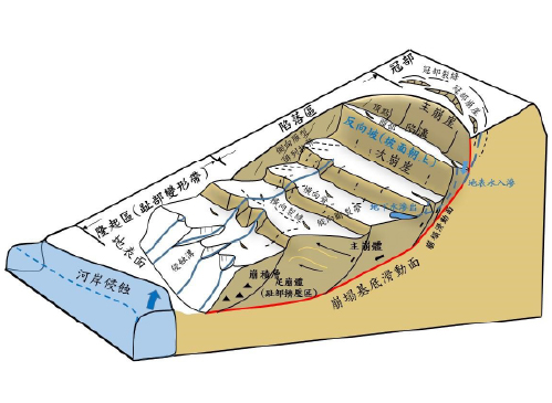
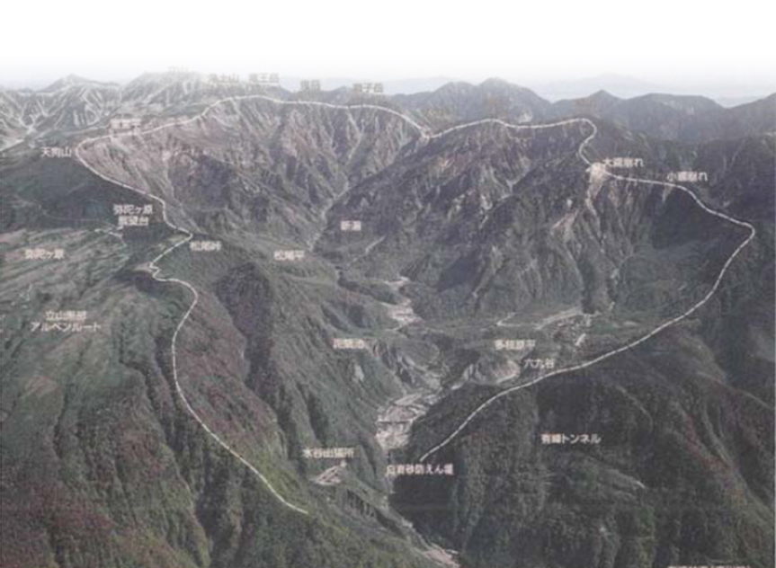
Primary Definition: Possesses the terrain and geological conditions for large-scale collapse occurrence
Evaluation Factor: Occurrence Potential
Scope Designation: Designated location and boundary
Primary Definition: Potential areas for large-scale collapse disasters (with households under protection)
Evaluation Factor: Residential Area Hazard Level
Scope Designation: Designated potential area and area of impact
Primary Definition: Areas with a serious risk requiring immediate engineering work and land-use restrictions
Evaluation Factor: 在 Priority of Control and Management
Scope Designation: Designated planning area (Disaster Potential Map)
Agency of Rural Development and Soil and Water Conservation(ARDSWC), MOA.
No.6, Guang-Hua Rd., Chung-Hsing New Village, Nantou, Taiwan, R.O.C.
Office hour:Monday to Friday
08:30~12:30, 13:30~17:30