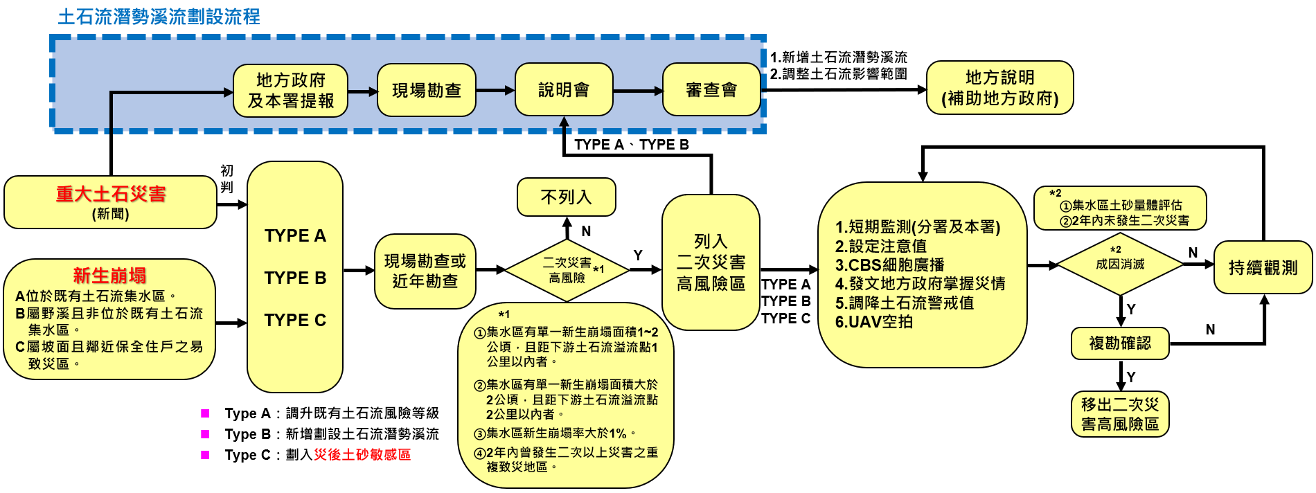
The assessment process for secondary disaster high-risk areas primarily involves information gathering, reporting by local governments, on-site investigation, and meeting review to systematically determine potentially affected areas and establish response measures, thereby enhancing disaster preparedness and safety.
1
Information Gathering
Collect major debris flow disaster events or use satellite imagery to identify new landslide areas.
2
Local Government and Agency Reporting
Local governments and the Agency of Rural Development and Water Conservation report suspected high-risk areas or new landslide areas.
3
On-site Investigation
Personnel are dispatched for on-site inspection to confirm the scale of the collapse, topography, and affected area.
4
Hold Information Sessions
Hold information sessions to explain the assessment results and potential risks to local governments and relevant units.
5
Hold Review Meetings
Hold review meetings to confirm the high-risk area scope and disaster prevention response measures, completing the formal assessment.
Diagram: Secondary Disaster High-Risk Area Delineation Process.
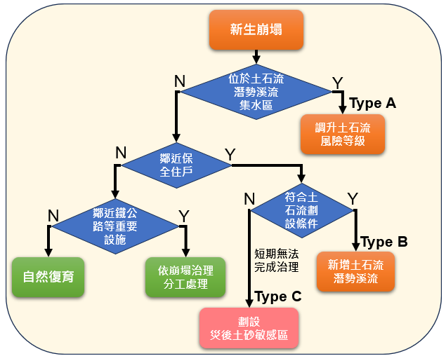
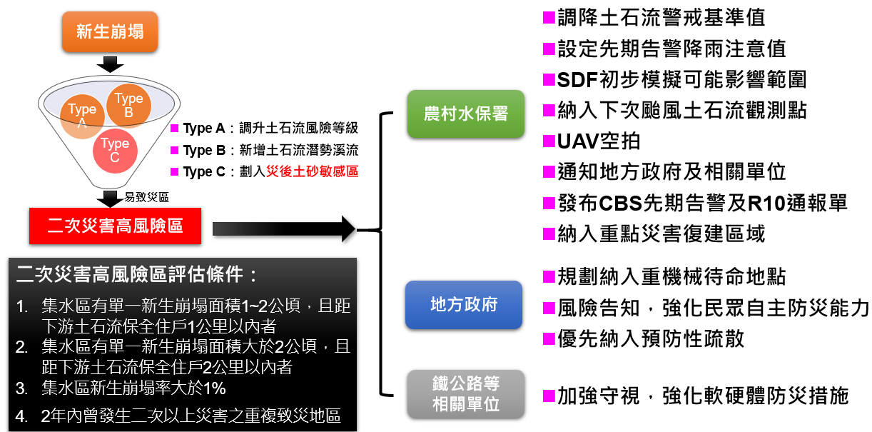
Secondary Disaster High-Risk Area Types
Secondary Disaster High-Risk Area Classification Process
Areas are classified into three types based on proximity to protected households and debris flow potential:
Type A: Located in existing debris flow watershed
Type B: Belonging to wild streams and not located in existing debris flow watershed
Type C: Belonging to slope surfaces and being disaster-prone areas near protected households
Early Warning Mechanism
Diagram: Early Warning Mechanism.
Disaster-prone areas within Type A, B, and C are collectively referred to as "Secondary Disaster High-Risk Areas," included in the next emergency response monitoring focus, and integrated with the Cell Broadcast Early Warning Mechanism.
2025 Rainfall Alert Value Setting Method
Rainfall Duration
Alert Value (mm)
1 Hour
20
3 Hours
40
24 Hours
80
2025 Secondary Disaster High-Risk Area Quantity
The cumulative number of secondary disaster high-risk areas from the 2024 0403 Earthquake, Typhoon Gaemi (凱米), Typhoon Krathon (山陀兒), Typhoon Kong-rey (康芮), 2025 Typhoon Danas (丹娜絲), and 0728 heavy rainfall is 40.
( respectively: Hualien County 16 locations, Kaohsiung City 8 locations, Pingtung County 3 locations, Taitung County 5 locations, Yilan County 2 locations, Nantou County 2 locations, Chiayi County 1 location, Taoyuan City 1 location, Hsinchu County 1 location, and New Taipei City 1 location)
Secondary Disaster High-Risk Area Management Measures
Secondary Disaster High-Risk Areas refer to regions where debris flows, landslides, and other disasters have occurred or are likely to reoccur. The criteria for determination include the area of new collapses in the watershed and the distance to downstream households, a new collapse rate exceeding a certain proportion, and areas that have been disaster-prone multiple times within the past two years. For these high-risk areas, the Agency of Rural Development and Water Conservation, local governments, and relevant transportation units must adopt comprehensive disaster prevention and response measures, including lowering alert thresholds, early warning, disaster simulation, aerial monitoring, notification, and preventive evacuation, to mitigate disaster threats and ensure public safety.